South Otselic Fish Hatchery
Services Applied by VCS Engineering
Project Introduction
Civil Construction Group and the New York State Department of Environmental Conservation (NYSDEC) sought to pinpoint an optimal location for a new well at the Fish Hatchery to address the insufficient water flow rate from a previously installed pumping well. The aim was to identify areas within the geologic river valley floor where localized rock and coarse gravel deposits were expected to be deepest, thereby potentially increasing the water flow pumping rate. To achieve this goal, NDT Division was contracted to profile the geologic river valley floor using advanced geophysical methods.
Project Scope
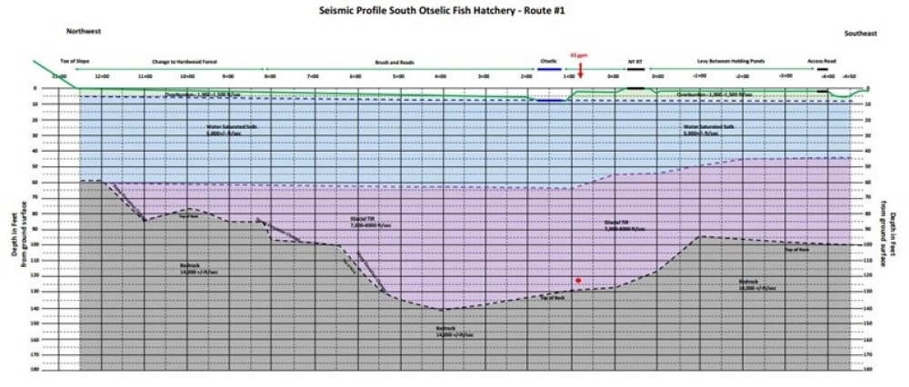
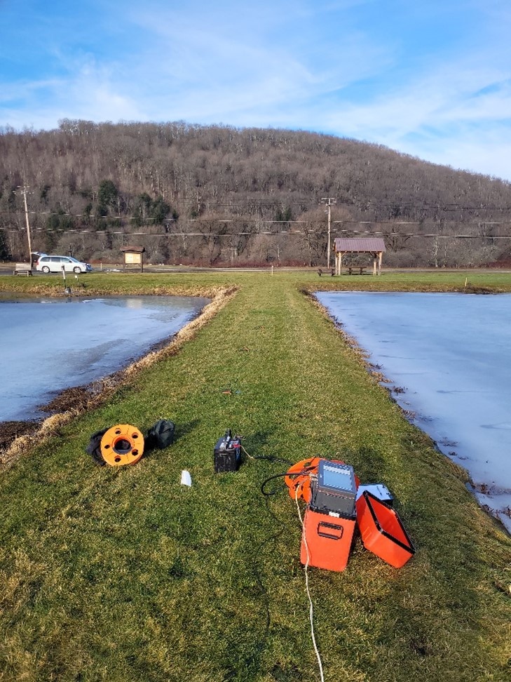
NDT Division embarked on the task of profiling the geologic river valley floor by collecting refracted energy wave data along two transects using overlapping 400-foot-long seismic lines. Geophones were spaced every 10 feet along these lines to capture accurate data. The arrival time of the energy waves was meticulously recorded and analyzed to obtain top-of-rock data to depths of approximately 150 feet. Utilizing a 24-channel seismograph, geophones, and a "betsy" seisgun energy source, NDT Division conducted the data collection to profile the top of the rock along the predetermined transects.
Project Solution
The results of the geophysical investigation provided by NDT Division yielded crucial insights for the NYSDEC Engineers in determining the location for a new well to meet the water needs of the Fish Hatchery. Transect 1 revealed a 300-foot-wide by 25-30-foot-deep section of bedrock, while Transect 2 unveiled a 700-foot-wide by 35-40-foot-deep "U"-shaped depression in the top-of-rock surface beneath glacial till deposits. The presence of this "U"-shaped depression suggested a potential pre-glacial riverbed where coarse gravel deposits might exist. Armed with this information, the NYSDEC Engineers could make informed decisions regarding the placement of the new well, optimizing water flow rates for the Fish Hatchery's operations.